Challenge
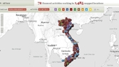
Natural hazards have resulted in average annual economic losses estimated between 1 and 1.5 percent of gross domestic product (GDP) between 1989 and 2008. For instance, the Typhoon Xangsane in 2006 caused damage of US$1.2 billion in the 15 provinces in the Central Region.
Infrastructure and people have been increasingly concentrated in vulnerable areas such as floodplains and coastal areas, suggesting that disaster-related losses will even increase in the future. An estimated 70 percent of Vietnamese people are exposed to risks from natural hazards—specifically in rural communities where livelihoods are most threatened. The project is aligned with the Vietnamese Government’s new National Strategy for natural disaster prevention, response and mitigation to 2020. Its ultimate goals are to minimize the loss of human life and properties and the environment, and to contribute to ensure the country’s sustainable development, national defense and security.
Solution
An integrated approach is being undertaken to help meet the challenges that rural communities face in living with natural hazards:
• First, communities receive training to develop their own preparedness strategies and to integrate disaster risk management (DRM) into their communes’ socio-economic development plans.
• Second, implementing new and better engineering standards for rural roads and irrigation infrastructure—both lifelines for rural communities, ensure their safety and livelihood.
• Third, enhancing livelihoods among poor households through an Agricultural Risk Management Information System (ARMIS) that assists farmers in improving productivity and enhancing resilience to droughts, floods, erosion, and heat. ARMIS also provides useful information on pest control, disease treatments, nutrient management, water conservation, planting dates and cropping patterns.
• Fourth, implementing structural risk reduction measures for dams, reservoirs and evacuation bridges help minimize adverse effects from disasters.
Results
• The success of the World Bank pilot on Community-based Disaster Risk Management (CBDRM) which had been implemented in 12 project provinces led the Vietnam government to develop a National CBDRM Program of US$450 million covering 6,000 communes across the country.
• 11 major flood and storm mitigation infrastructure, such as safe harbor, river dykes, evacuation roads, drainage pumping stations in the central region have been constructed and/or rehabilitated.
• More than 210,000 villagers in 30 communes implemented structural measures, including multi-purpose evacuation centers and drainage canals, along with non-structural measures, such as the development of Safer Commune Plans and evacuation drills. 100 percent of project communes received training and equipment for early warning systems.