FEATURE STORY

Indigenous people in Colombia have a plan to protect their environment from climate change

November 29, 2012


Image
Photo: Proyecto Madre Tierra. Organización Zonal Indígena del Putumayo 2010-2011.

STORY HIGHLIGHTS
  • Natural areas where indigenous people live are being affected by climate change.
  • Indigenous people of the Putumayo Department won a grants competition from the World Bank’s Development Marketplace in 2009 for projects on adaptation to climate change.
  • They elaborated five environment management plans that include studies and maps and allow them to better adapt to climate change.

The river Putumayo, broad and red, makes its way through the deep green forests. Many living species find their home there.

The indigenous people in the Putumayo department know many of them, on the river side or in the mountains. They consider their natural environment an essential part of their development, their well – being and culture.

But the natural areas are being affected by climate change, they say, – species are disappearing and there are more floods and droughts, endangering their survival, changing their living conditions.

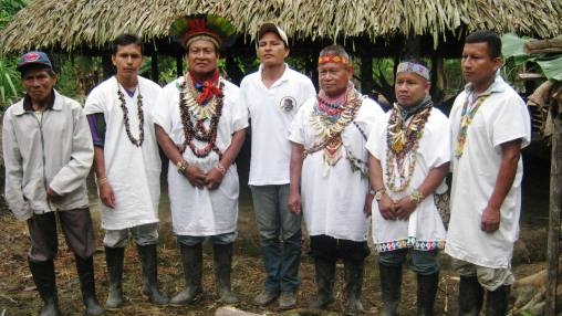
Pablo Jamioy, from the Camëntsá indigenous people and an entrepreneur who sells indigenous handcraft, together with others, decided their people needed a way of communicating with the government and other institutions.

They needed to show how rich the nature in their region was and what it meant to indigenous people, but also what problems it was facing, and how they were affected. They wanted to give an alternative response to what had been done so far.

 “Without territory, indigenous people can't exist”

Without their territory, indigenous people cannot exist, he explains. They wanted to propose a fair and adequate management of the territory, taking into account the traditional management ways of the indigenous people, making sure they could follow their traditions and rituals, hunt, fish, plant crops and drink clean water.

They applied to a competition of the Development Marketplace, a World Bank competitive grant program, that was seeking innovative projects on the adaptation on climate change at that moment – and they won a grant in 2009.

They have since then produced five environment management plans that address the social and economic needs of five indigenous groups in the Putumayo region. Now, the communities have solid tools that can help them to adapt themselves and act upon environmental changes.


" The communities themselves formed working groups. What we did is give them the GPS devices and with that they began their journeys. One journey could take 15 days walking in the mountain. "
Image

Pablo Jamioy


They developed the plans with the help of modern technology, with a research methodology, as well as the ancient knowledge of the indigenous communities living deep in the country side of the Putumayo Department.

Indigenous people gathered the information

The indigenous communities themselves gathered some samples and information after being trained in the use of GPS devices and basic cartography.

“The communities themselves formed working groups. What we did is give them the GPS devices and with that they began their journeys. One journey could take 15 days walking in the mountain,”says Pablo.

On top of being controlled by armed illegal groups, some of these areas were so isolated that only local indigenous people could travel there.

But these difficulties for the production of maps were overcome, partly with the use of satellite images – a strategy that could be reproduced in other parts of the world that have difficult access.

“The big job was to get to the communities and work with the members of the family”, Pablo explains.

For example, they got information from surveys and discussions with the communities. Several workshops and traditional ceremonies were undertaken with the communities so as to explain the purpose of the project.

The finished documentation includes registers of plants, with their name and use by indigenous people, 5 ecological calendars, regulation norms and 44 maps that show where the flora and fauna can be found, where indigenous people hunt, and where their holy places are.

The next step, Pablo says, is to implement their proposals, and seek support from different institutions. They already have presented their plans in a workshop organized by the World Bank, where representatives of the Ministry of the Environment were present.


Api
Api

Welcome