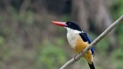
The Sundarbans – shared by India and Bangladesh – are home to the largest mangrove forests in the world. The area is crisscrossed by a labyrinth of rivers, canals and creeks, creating a dense patchwork of small islands on the huge Ganges-Brahmaputra delta. While the mangroves’ aerial roots act as natural fish nurseries, the region sustains a large variety of flora and fauna, including many endangered species such as the Royal Bengal Tiger and the Gangetic dolphin.
The Sundarbans have been declared a UNESCO World Heritage Natural Site in recognition of their unique biodiversity. While large parts of the Sundarbans remain uninhabited, over 4 million of India's poorest people live in two of its districts to fish and farm.
The region’s natural environmental balance, flora, and fauna are facing a serious threat from the reclamation of land for agriculture and settlement, cutting down of mangroves for timber and fire wood, setting up of fisheries in the rivers, canals, and creeks, excessive fishing throughout the year, indiscriminate collection of prawn seedlings, and the poaching of animals of commercial importance. The natural environmental balance has also been disturbed by the raising of embankments along the major river systems to prevent the ingress of sea water and the construction of irrigation and drainage canals over centuries that has interfered with the land’s natural gradients.
More than 5,000 square km of mangrove forests in the Indian part of Sundarbans have been reclaimed over the past 200 years, reducing the land’s resistance to the ravages of cyclones and soil erosion, and several important fish and prawn species have been declining.
In addition, a large volume of sewage flows into the Sundarbans from the major city of Kolkata, flowing through the East Kolkata Wetland, which provides some natural ecological treatment. Industrial pollution in the Hoogly river is rampant and there is an alarming amount of mercury in the Saptamukhi river as well as arsenic pollution in the Matla and Bidya rivers. Most of the effluents and solid waste from polluting industries in Haldia port end up in the coastal waters.
In the Digha area, the quality of land, water and air has been impacted by the number of diesel-driven fishing boats and the growth of fishing harbor activities. And the growth of tourism, a major economic activity, has led to a rise in hotel-building, road transportation, and illegal encroachment by small traders.
The coastal tract near Digha is being eroded by seawater, resulting in the lowering of the beach and recession of the bank. The rate of erosion has been found to be about 17 meters per year in some parts. Moreover, the quality of surface and ground water is changing due to incursion of salt water, especially in the Digha area - an indirect effect of shore line shift in this region.
Project activities
In West Bengal, the Integrated Coastal Zone Management (ICZM) Project is working in two pilot stretches, the Digha-Shankarpur coast and Sagar Island on the Indian side of the Sundarbans. Sagar Island is the largest island in the Bay of Bengal.
Pilot investments include protecting hazard-prone areas of the coastline from erosion by planting mangroves as a bio-shield. Regeneration of mangroves has started on 1,000 hectares. All fishing around Digha is to be certified by the Marine Stewardship Council.
To control pollution, existing sewerage works at Digha are being renovated to cater for projected population growth and the rise in tourist traffic till 2025. Grid electricity is being brought to Sagar Island to reduce pollution from diesel generation.
The livelihoods of coastal communities on Sagar Island are being improved through the generation of new afforestation-based livelihoods and the promotion of small-scale tourism and ecotourism activities. Eco-sensitive tourism infrastructure is being developed – including at Ganga Sagar, an important pilgrimage site at the confluence of the river Ganga and the sea.
The project is also working to develop Calcutta University’s capacity to study the area’s rich microbial diversity. Already, more than 300 new bacteria have already been found.