Skip to Main Navigation
Results Briefs May 2, 2022

Using Technology to Monitor Deforestation and Prevent Forest Fires in Brazil’s Cerrado Biome

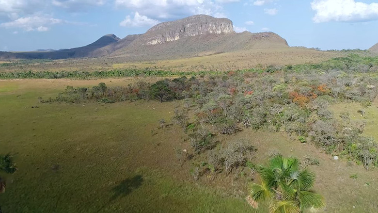
Aerial view from Cerrado Biome in Brazil. Credit: FIP

FIP


This project sought to achieve transformational impact by leveraging official, easily accessible, web-based monitoring systems, using state-of-the-art technology to deliver high-quality information about Brazil’s Cerrado Biome and use this information to actively address deforestation and forest fires. This project provided innovative public and private services and instruments, while prioritizing a gender responsive and balanced access to training and engagement opportunities. The services comprise a suite of over 40 analytical and spatially-explicit models, deforestation and fire event monitoring tools, as follows: On-demand Fire probability models; Tailored Satellite-based vegetation moisture estimation models for the Cerrado; Bayesian fire occurrence probability models for national parks; Monthly vegetation fuel load models; Geospatial Machine learning models applied to satellite imagery data used in fire management within Cerrado national parks; On-line fire ignition and fire spread risk for the Cerrado (FISC-Cerrado) coupled with climate models that simulate future long-term climate conditions; Fire occurrence and spread models; Prioritization models for integrated fire management actions in national parks; Post-fire vegetation dynamics models; Daily infrared enhanced maps for selected Conservation Units at 30m spatial resolution and at 500m spatial resolution at the regional level (for the entire Cerrado); Complete analysis of post-fire damage with data tabs and infographics, of burned areas, type of vegetation affected, carbon emissions source estimate; Vegetation regeneration model scaling up and further development under different fire regime scenarios; Fire risk prioritization model targeted to specific fire management activities taking place at within the Conservation Unit level. These tools are currently in use by more than twenty (20) national agencies responsible for strategic aspects of law enforcement, first response and monitoring of deforestation, fire prevention, and biodiversity conservation in the Cerrado Biome.

Beneficiary Story/Quote

Twenty five national institutions in Brazil are using the systems resulting from the project, some of the key institutions are: The National Center for Monitoring and Early Warning of Natural Disasters (CEMADEN); The National Indigenous People Foundation (FUNAI); Brazilian Institute of the Environment and Renewable Natural Resources (IBAMA); Chico Mendes Institute for Biodiversity Conservation (ICMBio); Brazilian Institute of Geography and Statistics (IBGE); Ministry of the Environment (MMA); Defense Ministry/Amazon Protection and Surveillance System (SIPAM); Brazilian Forest Service (SFB); Brazilian Agricultural Research Corporation (Embrapa). An external evaluation performed by The Natureza, Sociedade e Conservação Group (NSC) in 2021, pointed out that 100 percent of the institutions’ interviewees recognized the project’s contribution to institutional strengthening and 79 percent of managers recognized that it is now easier to collect and make use of updated data and information.

Quote from Minas Gerais fireman lieutenant Manoel Braga on the Fire Spread Risk Tool:

“This technology for mapping fire risk areas is essential for us to be able to act strategically and effectively to enhance and apply our efforts in the face of forest fires.”

Challenge

The Cerrado Biome is a great swathe of tropical savanna that extends across several states of Brazil, it is by far the largest savanna region in South America and the second largest South American biome. The core challenge for the management of this rich and varied collection of ecosystems was to balance the growth of agriculture in these states with conservation of natural vegetation, providing critical ecosystem services, maintaining rural livelihoods, and reducing greenhouse gas (GHG) emissions.

Approach

Addressing biodiversity and forest conservation, supporting reforestation, and promoting low carbon emission agriculture requires a robust system to monitor and manage forest fires. Such a system needs to provide data tools to environmental agencies to improve control and management of out-of-control fires, which often cross over into indigenous lands, smallholder farms, and protected areas. In 2021 the absolute number of fire outbreaks in the Cerrado corresponded to 31,566, with a yearly average of 27,501 fire events, covering a total area of 10,913.8 hectares (representing 5.4 percent of the entire biome affected by damaging fire events each year).

This Project enhanced Brazil’s institutional capacity to monitor deforestation, provide information on fire risks, and estimate related GHG emissions in the Cerrado. The World Bank organized its approach to the Cerrado by building partnerships with all levels of government, the private sector, and civil society. The Bank implemented an integrated approach of analytical studies, lending, trust funds, and partnership activities, grounded in principles of  flexibility, selectivity, and innovation.

Working with knowledge of vegetation cover, forest fires, and GHG emissions this project sought to transform paradigms and establish a culture in which forest resources were valued as an important environmental and socio-economic asset. It fostered rural development standards based on forest maintenance and promoted sustainable practices with climate benefits.

Results

The project contributed directly to CPF objectives by:

  • Creating, harnessing, and managing national capacities while developing long-lasting synergies between government institutions engaged in project implementation, four in total, covering multiple mandates in public administration, policy development and implementation, science, and technology.
  • Adding to national government efforts to maximize its effectiveness for sustainable, inclusive, and efficient service delivery within more than twenty national agencies concerned with policy development, environmental protection, law enforcement, climate change, and biodiversity conservation in Brazil (15 agencies was the Project’s original target).
  • Enabling the development and uptake of state-of-the-art analytical tools and approaches (>40 tools in total) that allow better: i) fire risk and deforestation monitoring, early detection, and prevention (28 analytical tools); ii) biodiversity conservation (5 analytical tools); iii) climate change mitigation and adaptation (7 analytical tools); iv) sustainable development and natural resource management (4 analytical tools).
  • The project contributed to maximizing national capacities through workshops and training modules delivered to more than forty-two institutions active in the Cerrado biome (reaching a number of 1,217 individuals across sectors in academia, journalism/media, government officials, researchers, and the general public)


Key Project Outputs and Outcomes are, as follows:

From 2018 to 2021 the following key results were achieved under the Project:

    a) Over 45 Cerrado-specific data and technology products (e.g., models, analytical tools, data layers) were produced, validated, and made available to first responders, policy and decision makers.

    b) Near real-time systematic and comprehensive information on deforestation in the Cerrado was made available to national institutions and to the general public, through the project’s webpage, technical reports, national statistics, imagery, and maps in the digital format.

    c) Over twenty-three government institutions in charge of policy, deforestation control, and fire prevention in Brazil began to use information on deforestation and fire risk for the Cerrado. These institutions have also been provided with training and capacity building to improve and further buttress their actions towards management of forest land and resources. Key institutions now using products resulting from the Project are, as follows: The National Center for Monitoring and Early Warning of Natural Disasters (CEMADEN); The National Indigenous People Foundation (FUNAI); Brazilian Institute of the Environment and Renewable Natural Resources (IBAMA); Chico Mendes Institute for Biodiversity Conservation (ICMBio); Brazilian Institute of Geography and Statistics (IBGE); Ministry of the Environment (MMA); Defense Ministry/Amazon Protection and Surveillance System (SIPAM); Brazilian Forest Service (SFB); Brazilian Agricultural Research Corporation (Embrapa).

Over the course of 2019 the following key results were achieved under the Project:


    a) A web-based platform, TerraBrasilis, was developed to host and make accessible deforestation data and tools for the Cerrado biome. The platform systematized representation and delivery of Cerrado-specific datasets from Projeto de Monitoramento do Desmatamento na Amazônia Legal por Satélite (PRODES) and Sistema Nacional de Detecção do Desmatamento em Tempo Real (DETER), making retrieval of complete wall-to-wall deforestation information available to government and to the members of the public.

From 2020 to 2021 the following key results were achieved under the Project:


    a) First of its kind forest fire risk and dispersion models, datasets, and information with improved GHG estimation for the Cerrado were made accessible and used by government institutions, decision makers, and the general public. Twenty-two percent of Brazil’s population (the equivalent to 42.7 million people) live in the Cerrado region and therefore directly or indirectly benefit from the fire risk information and tools generated by the project).

Bank Group Contribution


The World Bank, acting as implementing entity of the Forest Investment Fund under the Strategic Climate Fund, provided a grant for US$9.25 million to help finance this project. The project used $4.39 million of this allocation to fund deforestation monitoring efforts, put $3.31 million towards the development of information systems on forest fire risk and GHG emissions estimation, and dedicated $1.55 million to project management, monitoring, and evaluation.

Partners

The project was implemented by Research Development Foundation (FUNDEPE) in the role of overall project management and the Ministry of Science, Technology, and Innovation (MCTI) as the national government agency in charge of technical supervision. The National Institute for Space Research (INPE), Federal University of Minas Gerais (UFMG), and Federal University of Goiás (UFG) were responsible for the implementation of technical activities, training, and the delivery of tools and other products resulting from the project.

Looking Ahead

Synergies between project activities and institutions have generated reinforcing positive impacts during project implementation, which may be carried forward after the end of the project. This has been reflected in increased capacity within institutions, coordination, ability to mobilize resources, and translate technical knowhow into operational activities to the benefit of public and private actors present in the Cerrado. Furthermore, given the Cerrado’s strategic importance in the context of global climate change, sustainable production, and improved natural resource management, the results of the project have the potential to lead to further efforts connected to objectives in the Country Partnership Framework for Brazil,

Learn More