Mantoria is a coffee farmer for Kerinci Barokah Cooperative in Jambi Province, Indonesia. The coffee farm is in the vicinity of Kerinci Seblat National Park –a protected area–making secure land rights essential. Photo credit: World Bank, 2022.
As many as 2.5 billion of the world’s people—around one in three—rely on land, natural resources, and ecosystems for their well-being and livelihoods. But an astonishing 70 percent of the world’s population lack secure rights over their land.
The World Bank is supporting the government’s efforts through its Program to Accelerate Agrarian Reform (the One Map) Project ($240 million), which conducts village-based participatory mapping and registration of land rights in 10 provinces. The project aims to register 7 million land parcels in rural areas by the end of 2024. By mid-2023, it had mapped over 6.6 million land parcels, putting it well ahead of schedule.
In the past, processing and obtaining land certificates was very complicated and took a long time. Thank God, I am now able to assign my land certificates to all my children.
Sentot Sunaryohadi, 68, a farmer from Gendro Village, East Java.
Involving Communities in Land Registration
Community consultations and participatory mapping are integral to land registration. With support from the Sustainable Landscape Management Multi-donor Trust Fund ($37 million), One Map Project developed and refined participatory mapping methods that ensure the inclusion of vulnerable groups such as indigenous people and women. As a result, 50 percent of the land parcels mapped under the project are registered in women’s names. Women are also working as land data collectors, accounting for 18 percent of hires. Involving communities promotes inclusivity, empowers local stakeholders, and enhances the effectiveness of the mapping activities.
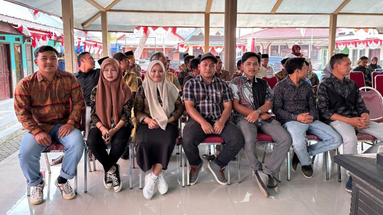
The success of the project is evident in Pasuruan Regency, East Java, where most of the 93,600 inhabitants depend on agriculture and livestock breeding for their livelihoods. Between August 2022 and August 2023, more than 58,000 land parcels were mapped and certified in 29 villages —100 percent of the program’s target.
“In the past, processing and obtaining land certificates was very complicated and took a long time,” said Sentot Sunaryohadi, 68, a farmer from Gendro Village in Pasuruan Regency, East Java. “Thank God, I am now able to assign my land certificates to all my children.”
Before the reform, there were uncertainties regarding the land mapping and registration processes, leaving communities insecure about their land tenure and the length of time needed to obtain a certificate. Thanks to the reform, this process has become more systematic, allowing communities to understand the process better, and the government (including local Land Offices) to support communities more effectively.
Land Data Collectors in Gendro Village, Pasuruan Regency, consult regularly with village communities. Photo credit: World Bank 2023
The success of the project in Pasuruan Regency can be credited to good communication and coordination between the Pasuruan Land Office and local village officials. The existence of Land Data Collectors (Pengumpul Data Pertanahan [Puldatan])—community members who act as trained facilitators at the forefront of the village data collection process—played a crucial role in building communities’ trust in the program. They provide communities with information on the importance of land rights and collect data in support of the Regency Land Office. As a result of this participatory approach and trust-building process, effective, constructive, and regular communications with all stakeholders were established and land-mapping targets are being achieved.
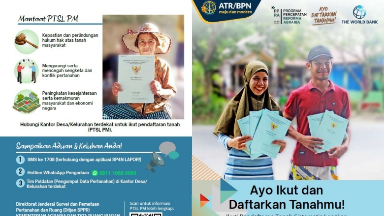
A promotional flyer prepared by the Ministry of Agrarian Affairs and Spatial Planning/National Land Agency prepared to encourage community participation and involvement in the Agrarian Reform Program. Source: One Map Project Management Unit, 2023
Securing Land Rights in Forest Areas
While Indonesia has made progress in securing land rights in agricultural areas, Indonesia is also paying attention to rights in Forest Areas, where over 37 million people live. These areas cover 63 percent of Indonesia’s total land area.
This effort aligns with the country’s climate agenda. Indonesia intends to meet more than 60 percent of its emission reductions through actions in Forestry and Other Land Uses (FOLU) sectors, a goal set out in its Forest and Land Use (FOLU) Net Sink 2030 plan. Secure land use rights will help support implementation of the FOLU Net Sink targets by strengthening environmental and forestry governance and providing communities with the security and livelihood support they need to manage natural resources sustainably.
Land use rights are more complex in forest areas than elsewhere, and many forest dwellers remain without clear land use rights. Yet innovative programs are making good progress in enabling communities to conduct sustainable forestry activities in forest areas as well as strengthening community management. The World Bank and Global Environment Fund (GEF) is supporting the Government’s Strengthening Social Forestry Project ($14 million), supporting issuance of 339 social forestry permits and 105 social forestry management plans (Rencana Kerja Perhutanan Sosial, RKPS) for a total area of 61,181 hectares – almost the size of Indonesia’s capital, Jakarta. Challenges remain, however, because of the complexity of determining use rights in State Forest Areas, mapping their extent (which is sometimes contested), and reconciling them with public forest management goals.
The government is also working to clarify administrative responsibilities and forest boundaries; secure land tenure of vulnerable communities (including communal and customary lands); and strengthen climate-resilient spatial planning. To support these efforts, the Sustainable Landscape Management Multi-donor Trust Fund is supporting inter-institutional dialogue and providing technical inputs in the form of capacity buildingfor participatory integrated registration and mapping procedures. These techniques are built on lessons learned from the One Map Project. Through such efforts, stakeholders can come together to balance competing land use demands and make progress toward Indonesia’s climate and rural development goals.
This site uses cookies to optimize functionality and give you the best possible experience. If you continue to navigate this website beyond this page, cookies will be placed on your browser. To learn more about cookies, click here.