Challenges
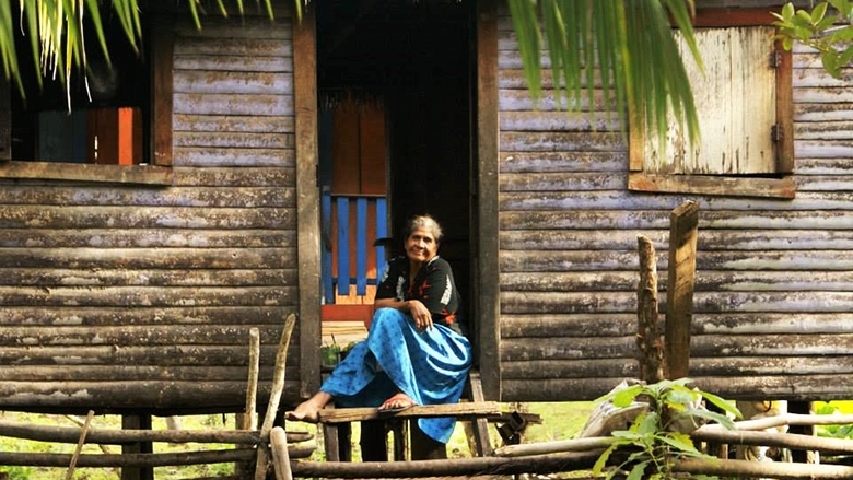
Land tenure in Honduras was often insecure due to unreliable cadastral and legal information, weak inter-institutional coordination, and inadequate conflict resolution mechanisms. Rural areas faced the most significant challenges, particularly in La Mosquitia, where indigenous peoples have been particularly affected by land dispossession and lack of effective legal protection.
Approach
The Second Land Administration Project (PATH II) was the second phase of an adaptable program loan aimed at increasing land tenure security in Honduras by improving decentralized land administrative services, including access to more accurate information on property records and transactions. During the first phase (PATH I), the Property Institute was created and attached to the Ministry of the Presidency to establish, maintain, and update the integrated property system. The project relied on consultative and participatory processes as well as conflict mitigation and resolution that benefited indigenous and nonindigenous communities in rural and urban areas.
Results
The following results were achieved during the lifetime of the project, from 2011 to 2017.
Increased tenure security and local governance of Miskito indigenous peoples by:
- Titling 78 communities of Miskito indigenous peoples, benefiting 26,740 community members.
- Training 117 indigenous community leaders, 48 of them women, on alternative conflict resolution mechanisms.
- Training 109 indigenous community leaders, 40 of them women, on managing land and natural resources.
Increased land tenure security by:
- Recording the ownership rights of 174,239 parcels (deed system).
- Surveying 10 municipalities.
- Supporting the establishment of six municipal associated centers.
- Issuing new titles to 50,798 households in rural and urban areas, about 48 percent of which went to woman-headed households.
Contributed to sustainable land and natural resources management by:
- Demarcating three protected areas, contributing to improved certainty about boundaries and thus clarifying management of natural resources and protected areas. The legally recognized areas are Refugio de Vida Silvestre Mico Quemado, Zona de Reserva el Merendon, and Refugio de Vida Silvestre Colibri Esmeralda Hondureno.
Strengthened legal and institutional framework by:
- Issuing Property Institute regulations for the certification of associated municipal centers.
- Developing technology platforms for the Property Institute and for integrating the registry and cadaster.
- Maintaining a high rate of accuracy (97.6 percent) for the Integrated Registry Module (SURE) under the National Property Administration System (SINAP).
- Training, certifying, and registering 1,117 professionals from the private and public sectors to use the Integrated Registry Module (SURE).
- Training 1,088 technical surveyors.
- Strengthening local capacity in 10 municipalities, all of which now use the cadastral information generated by the project for multiple purposes.
- Supporting the design of territorial plans for six municipalities.
Strengthened public and private partnerships by:
- Supporting the design of new SURE modules, prepared to provide technical support to participating private partners. The project supported front/back office model pilots in two banks, FICOHSA and BANPROVI. (Front and back characterize interfaces and services, respectively, provided to registry users.)
- Supporting a front/back office model pilot to improve investor registration in the Chamber of Commerce of Cortes (CCC). The pilot has proven to be effective at speeding up registration and certification of private investors, which now occurs in just one day. In 2016, 1,779 registrations were issued, an accomplishment expected to contribute to an improved “Doing Business” rating for Honduras.
Bank Group Contribution
The World Bank, through the International Development Association, provided a loan of US$ 32.8 million to finance Honduras’s Second Land Administration Project.
Partners
The UN Food and Agricultural Organization (FAO) was a key partner of the Bank and the Honduran government and provided technical expertise during project implementation as well as for monitoring and evaluation, economic analysis, and appraising the effectiveness of the final project.
Beneficiaries
The project benefited urban and rural households. Emphasis was placed on improving outcomes for women, particularly those who are heads of their households. The Miskito indigenous people benefited from the demarcation and titling of 78 communities. At an institutional level, the National Agrarian Institute and the Institute for the Conservation and Development, Protected Areas and Wildlife, were among the government institutions benefiting from access to SURE. The capacity of selected municipalities was strengthened by the cadaster and land record system, and six were certified as associated municipal centers, which built their capacity for territorial planning and land valuation.
Moving Forward
Although a follow-on project has not yet been prepared, the Property Institute has indicated its interest in a new Bank-financed operation focused on strengthening and consolidating the SINAP and the digitalization of land records at the national as well as municipal levels.
Learn More
For detailed Project information and key documents see: Link

