Challenge
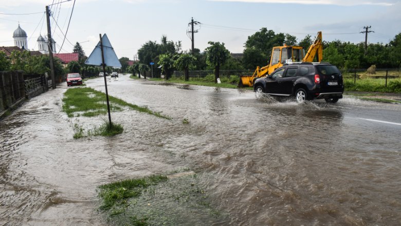
Romania is a flood prone country. Since the year 2000, floods killed over 240 persons in Romania.1 The preliminary flood risk assessment, realized by Romanian authorities in compliance with the European Union (EU) Floods Directive for the second time in 2019 identified 526 Areas of Potential Significant Flood Risk as possible risk hot spots across the country also including urban and coastal areas. For an in-depth assessment of the flood situation in these areas and to establish the knowledge base for preparing Flood Risk Management Plans (FRMP), new accurate Flood Hazard and Flood Risk Maps (FHRM) were to be developed and published. The existing methodological framework needed improvement considering actual international best practices and the available data, as well technical and institutional capacities were insufficient to develop high quality maps in the given time to comply with the EU Floods Directive and to set the basis for effective flood risk management planning.
Approach
During detailed stocktaking assessment at the beginning of the project, World Bank reviewed Romania’s methodologies, models, and maps from the first cycle implementation of the EU Floods Directive (2011-2016).
Considering best practices from other EU Member states and beyond, the World Bank supported Romania to develop new methodologies for modelling flood hazards that covered different flood sources, including fluvial flooding, flash floods, pluvial and coastal flooding and for quantitative flood risk assessment. The new approach also allowed the assessment of climate change impacts.
To satisfy the immense need for different types of data in high accuracy and resolution, the World Bank supported Romania to compile and assess all existing information and collect new data using state of the art technologies and innovative approaches such as the use of airborne Light and Detection Ranging (LIDAR) sensors for developing new digital terrain models and machine learning to develop a detailed exposure data set from orthophotos and other open data sources.
Thanks to a thorough data management, the mobilization of a high number qualified national and international flood experts and the use of cloud computing the World Bank was able to realize all modelling and develop accurate maps for all 526 areas. A web viewer tool allowed the client with support of the Bank to engage local stakeholder in the quality review and validation and later to report to European Commission and publish the new maps on the internet.
Results
- New flood hazard maps indicating flood extent, flood depth and in some cases flood velocities for different annual exceedance probabilities, including a climate change scenario in all identified areas of potential significant flood risk.
- New flood risk maps that include the exposed elements at risk of flooding, including housing, social infrastructure such as schools and hospitals or transport infrastructure.
- A systematic flood risk assessment that allows to quantify the expected damages per sector and shows that the overall annual expected damage due to flooding in Romania is EUR 1.7 billion affecting up to 150.000 citizens every year.
- A user-friendly web-viewer embedded in Romania’s new website on flood risk, that allows farmers, business owner and citizens to review the flood risk in their area. Local authorities, architects and urban developers can consult the maps during land-use planning to avoid creating new risks and civil protection agencies can better prepare themselves for emergency response in the case of flood events.
- Better and planning and prioritization of measures to strengthen flood prevention and protection and improved new FRMPs. The new maps enable water authorities to identify and appraise effective measures to reduce flood risks. The underlying hydraulic models are used to assess in detail the impact of proposed measures on the flood extent and flood depth and with the risk assessment the avoided damages and benefits can be analyzed to better justify the needed investments.
- Strengthen technical and institutional capacities. In the context of developing the maps, the World Bank supported the Romanian partner not only in the collection and management of data, but also in the modelling and risk assessment, as well as in communication and stakeholder engagement. This contributed to strengthen Romania’s capacities for flood risk management and water resources management in general.
Partners
In its support to Romania, the World Bank worked closely with the Romanian Ministry of Environment, Water and Forests, the National Administration “Romanian Waters” and its eleven local River Basin Administrations and the National Institute of Hydrology and Water Management.Moving Forward
Looking Ahead
World Bank is now supporting Romania to develop and report the new Flood Risk Management Plans based on the new maps. This includes the identification, appraisal and prioritization of structural and non-structural measures using multi-criteria-analysis and cost-benefit analysis. Where possible, these measures will be packaged into integrated flood risk management projects. Robustness checks will then test if the prioritized projects are in line with European environmental legislation, if they can be adapted to changing conditions due to climate change and if they meet the requirement of funding sources (e.g., in the context of the EU Green Deal). This way Bank supports Romania in developing bankable projects based on the thorough assessment realized during the Project that will reduce the flood risk for Romania’s people.
The approaches used for the development of the new maps were presented to other EU Member States during the regular exchange in the context of the Working Group Floods of the European Commission. The World Bank promotes the knowledge spill over and lessons learned through the Project in Romania already informed the development of a new flood risk management operation in Brazil.
