Located in the Himalayan mountains and separated by rivers, Bhutan’s topography makes transport challenging. Indeed, the roads connecting communities and settlements through or along mountains are no less than an engineering marvel. However, many of these roads are extremely vulnerable to geohazards such as landslides and debris flows.
Bhutan’s Department of Roads (DoR) which maintains some 3,000 kilometers of national highways across the country, recently held a training session on geohazards. Participants learned about the uses of the Geohazard Road Asset Management System prepared on the ArcGIS Online Mapping platform for better road maintenance planning.
With a goal to streamline efforts surrounding road hazard planning, the World Bank Task Team in the Climate Change and Disaster Risk Management Unit, and ITS Geospatial teams collaborated to produce a web-based mapping dashboard. The World Bank team processed information required to quantify geohazard risks along the 3,000 km long national highways across all of Bhutan including terrain aspects. The final dataset included historical landslide locations, slope, and drainage areas, road asset aspects such as roads and bridges, and seismic and climatologic hazard information such as predicted flooding areas corresponding to various rainfall return periods.
This information was programmed into a web-based interactive dashboard that displays dynamic infographics, charts, and summaries based on user-selected filters. For instance, users can access road hazard information on a granular level such as a specific district or class of road. To ensure a smooth data transfer in the future, our team utilized an existing a mobile-based data collection app so that data from ongoing surveys conducted by DoR can be brought into the dashboard in real-time.
To facilitate the stakeholders with a holistic overview of the risk, the condition of the road assets over time is also recorded in the web-based dashboard. This information is based on DoR’s historical road inspection results such as defects of retaining wall, failed slopes, road surface conditions, and blockage of culverts observed by the DoR inspectors.
A comprehensive mapping tool that includes information on risk, asset, and exposure data is crucial for technical agencies and policymakers alike in prioritizing maintenance work, planning of new roads, road widening projects. Geohazard risk and road asset information combined and overlayed allows for visually identifying road segments that require maintenance.
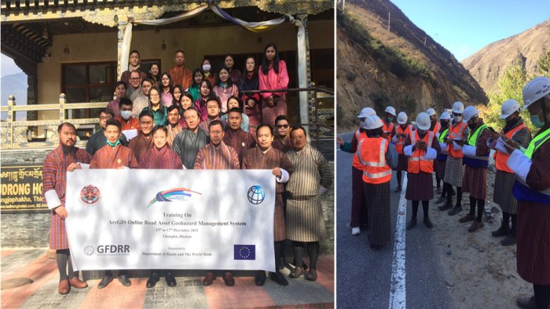
No data dashboard is complete without an effective data collection strategy. During the staff training in December 2021, the DoR developed a couple of new field survey forms for flood and other hazards through a streamlined application (Survey 123) that will be used for field data collection and is tied into the online mapping database. Standard Operation Procedures (SOPs) have been prepared as well to keep the database updated.
“The online mapping platform has streamlined our field data collection, data update and data management within the Department significantly. More than 400 field records were added to the database from regional offices within a month of the training.” said Yeshey Penjor, a former Executive Engineer of the Maintenance Division from the Department of Roads. "These are huge datasets but the tool being web based, it eliminated the requirement of storage devices and ensured better protection against data loss.”
Some of the key lessons learned are worth highlighting:
1. System development: With the support from the World Bank ITS Geospatial team, DoR Bhutan was able to move from a disconnected database to an online mapping tool that is user-friendly and cost-effective. After the ArcGIS Online prototype was prepared internally on the Bank server, the system was transferred to the DoR server.
2. Online mapping: A decentralized data storage mechanism made it difficult for the database updated with road inspection results. Traditionally, the geohazard road asset database was stored in a localized hard drive maintained by select DoR engineers in Thimphu. Now with online mapping, DoR staff from the regional offices can view and add data from their respective offices.
3. Risk information for planning: The visualizations produced in the data dashboard provide a holistic overview of geohazard risk and condition information of the roads. By enabling the online mapping, the local government can plan ahead for budget operations and periodic maintenance as needed.
4. Information sharing with relevant stakeholders: A web-based mapping dashboard enables DoR to share critical road and risk information with other government agencies in a streamlined manner. This will be implemented in an upcoming World Bank-funded project Strengthening Risk Information for Disaster Resilience in Bhutan which became effective on December 11, 2021. The DoR is one of the implementation agencies of the project.
Several experts contributed to the engagements in Bhutan. Authors Masatsugu Takamatsu (SSACD) and Robert Mansour Harrison (ITS Geospatial Team) would like to acknowledge David L. Oliver and Marta P. Rodriguez from INES, Dr. Thomas Oommen and Dr. Karma as external geotechnical experts, and Mr. Dorji Gyeltshen P and Mr. Yeshey Penjor from the Maintenance Division of the Department of Roads, and fellow World Bank colleagues including Mehsum Basharat for facilitating the communications aspect of the TA. Finally, we would like to acknowledge the generous funding support from the EU for this South Asia Regional Global Facility for Disaster Risk Reduction (GFDRR) TA on strengthening resilience to geohazard risks.