FEATURE STORY

Shared Data Helps Caribbean Islands to be Better Prepared for Disasters

February 28, 2013

Image

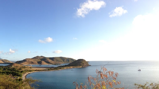
Panoramic view of St Kitts and Nevis.

Sara Gionnazzi

STORY HIGHLIGHTS
  • Eastern Caribbean islands are highly prone to hurricanes, heavy rains, high winds, droughts, landslides and earthquakes.
  • Last year Saint Lucia launched its first national data sharing and management platform.
  • Having geospatial information about vulnerability and risks helps authorities make better and informed decisions.

Information is power. Sharing and using that information to reduce a country’s vulnerability to natural disasters can make the difference between life and death.

This is especially relevant for the Eastern Caribbean islands, which are highly prone to hurricanes, heavy rains, high winds, droughts, landslides and earthquakes, posing a serious threat to human life and the local economy.

In recent years, the volume of spatial data has grown exponentially - and now it includes topography, location of schools, health centers, infrastructure, and any record that can be associated with an address or geocode.

Even though spatial data is critical for building resilience to natural hazards, this information is often difficult to find and access and frequently incompatible across ministries or agencies. Spatial data helps to develop decision-making tools, such as land use maps, engineering designs, and flood risk analyses. That's why so many countries are seeking to improve their spatial data management.

Such is the case of Saint Lucia, which last year launched its first national data sharing and management platform called "Saint Lucia Integrated National GeoNode" (SLING).

" Every time we build a school, a house, a bridge, we have the potential of putting population at risk. Having geospatial information about hazard, vulnerability and risks helps us make the right decision in the first place "

Francis Ghesquiere

Manager of the Global Facility for Disaster Reduction and Recovery

An open platform

GeoNode is an open-source geospatial data sharing and management platform, which allows national ministries and agencies to populate, catalog, view, and share data on a central repository.

With this platform, “decision makers are better equipped to develop efficient disaster risk management strategies and adapt to increasing climate variability,” said Niels Holm-Nielsen, World Bank Senior Disaster Risk Management Specialist.

With support from the World Bank, a GeoNode training for Saint Lucia’s Ministry of Education examined two data sets, schools and health centers. By overlaying these datasets, trainees were able to identify the need for additional medical facilities, for example, in the case of a national disaster.

“Every time we build a school, a house, a bridge, we have the potential of putting population at risk. Having geospatial information about hazard, vulnerability and risks helps us make the right decision in the first place,” said Francis Ghesquiere, Manager of the Global Facility for Disaster Reduction and Recovery.

In addition to Saint Lucia, Grenada, Saint Vincent and the Grenadines, Belize and the University of West Indies are using GeoNode to facilitate regional information sharing and data management for land management and risk assessments in the region.

"Moving forward, the biggest challenge will be to continue fostering and maintaining a culture of data sharing, uploading new data, and using metadata," said Jim Joseph, Saint Lucia’s Geodata Coordinator.

Dominica and the Caribbean Catastrophe Risk Insurance Facility plan to join GeoNode in the near future.


Api
Api

Welcome