Events
16th Disaster Risk Management Seminar "Seismic Hazard Mapping for Community Resilience"
16th Disaster Risk Management Seminar "Seismic Preparedness Map for Community Resilience"
November 11, 2016Tokyo


Disaster Risk Management Seminar Series: Organized by the World Bank Tokyo Office and World Bank Disaster Risk Management Hub, Tokyo

How much do you know about the risks from natural disasters your community is exposed to? Do you know where your nearest evacuation site is, and route options in your local area?

Japan has equipped its community with a tool so-called "Seismic Preparedness Map" that address such questions and help community understand the potential risk from natural disasters in their own locality, and prepare themselves for emergency situations. The local governments have supported the development of these Seismic Prepardness Maps, and as a result most communities have access to information about the risk they are exposed to. To share this Japanese approach, a step-by-step handbook on how to develop Japanese style Seismic Prepardness Maps has been developed by the World Bank Disaster Risk Management Hub, Tokyo. This handbook is a practical tool to assist local governments and communities prepare this risk communication tool.

Innovative efforts in risk mapping are evolving at global scale. This seminar will highlight unique disaster prepardness mapping approaches, and discuss challenges and possible solutions leveraging risk assessment results for making communities more resilient.


Program

Opening Remarks

Yasusuke Tsukagoshi
Special Representative, Japan, World Bank Group

Presentations

Keiko Saito
Disaster Risk Management Specialist, Global Facility for Disaster Reduction and Recovery, World Bank
"Seismic Preparedness Maps" PDF (English and Japanese)

Junichi Hasumi
Assistant Director, General Affairs Division, Department of City Planning, City Planning Bureau, Saitama City, Japan
"Risk Assessment and Concrete Measures on Saitama City Disaster Prevention and Urban Development Plan" PDF (Japanese)

Yantisa Akhadi
Project Manager, InaSAFE, Humanitarian OpenStreetMap Team, Indonesia
"InaSAFE and Data Preparedness" PDF

Moderator

Keiko Sakoda Kaneda
Disaster Risk Management Specialist, Disaster Risk Management Hub, Tokyo, Global Facility for Disaster Reduction and Recovery, World Bank


❖ This session will be recorded for later viewing.

❖ The session will be live streamed.

Speakers

Our Activities


Image

ImageYasusuke Tsukagoshi
Special Representative, Japan, World Bank Group

Mr. Yasusuke Tsukagoshi became Special Representative, Japan on August 1, 2013. The Special Representative leads the institutional relationship with the Japanese Government, partners, and stakeholders; oversees the World Bank Tokyo Office; and has responsibility for coordinating and managing outreach and communications programs in Japan. Mr. Tsukagoshi, a Japanese national, has had a long career in Japan’s Ministry of Finance (MOF). Most recently, he served as Director General of Tokyo Customs following senior positions in the Ministry’s Customs and Tariff Bureau. Prior to the Customs’ positions, he had 17 years of experience in international finance and development. From 2008 to 2011 Mr. Tsukagoshi was Executive Director at the Inter-American Development Bank, representing Croatia, Japan, Korea, Portugal, Slovenia, and the United Kingdom, and from 1988 to 1991 he served as Executive Director at the African Development Bank, representing Argentina, Austria, Brazil, Japan, and Saudi Arabia.


ImageKeiko Saito
Disaster Risk Management Specialist, Global Facility for Disaster Reduction and Recovery, World Bank

Ms. Keiko Saito is a Disaster Risk Management Specialist with the Global Facility for Disaster Reduction and Recovery (GFDRR) Innovation Labs team. She specializes in the application of geospatial data for disaster risk management. She brings with her more than 10 years of experience in this field. Her interest is in bringing in the geospatial dimension into disaster risk management for all stages of the disaster cycle, from preparedness through to recovery and reconstruction. She has been helping organize hackathons around the world that she hopes to make an impact at the community level to reduce the risk from disasters, by generating innovative, community based disaster preparedness measures that also eventually feedback into policy levels. Prior to joining the World Bank, she was a Director at Cambridge Architectural Research Ltd. working in a multidisciplinary risk management and assessment team, a Willis Research Fellow and a Senior Research Associate at the Department of Architecture, University of Cambridge. Ms. Saito has an M.Phil in Geography and a Ph.D. on the use of remotely sensed data for post-earthquake damage assessment both from the University of Cambridge, U.K.


Junichi Hasumi
Assistant Director, General Affairs Division, Department of City Planning, City Planning Bureau, Saitama City, Japan


ImageYantisa Akhadi
Project Manager, InaSAFE, Humanitarian OpenStreetMap Team, Indonesia

Mr. Yantisa Akhadi is the Project Manager of Humanitarian OpenStreetMap Team (HOT) in Indonesia. He oversee all of HOT projects in Indonesia, from supporting disaster management agencies to innovative mapping project with local communities. In the past 10 years, he has been involved in the use of ICT and geospatial technology in various disaster phase, both in national and international level. Prior to joining HOT, he worked with United Nations Development Programme to strengthen the capacity of National Disaster Management Agency in the field of disaster data management. Mr. Akhadi holds a Master of Spatial Information Science from The University of Melbourne with the focus of spatial visualization of disaster data.


ImageKeiko Sakoda Kaneda
Disaster Risk Management Specialist, Disaster Risk Management Hub, Tokyo, Global Facility for Disaster Reduction and Recovery, World Bank

Ms. Keiko Sakoda Kaneda is a Disaster Risk Management (DRM) Specialist at the Global Facility for Disaster Reduction and Recovery (GFDRR) DRM Hub Tokyo. She works on technical assistance grant portfolio, and supports connecting Japanese relevant experience with the World Bank’s operational teams, beyond the traditional DRM community, for mainstreaming DRM in various sectors. She brings solid operational expertise in post-disaster/conflict reconstruction, disaster preparedness, climate change adaptation and urban development from nearly 10 years of experience. Her focused experience in post-disaster/conflict housing reconstruction added value to recent Bank operations in Nepal and Vanuatu after devastating disasters in 2015. Prior to joining the World Bank, she worked at UNDP and UN-Habitat in Indonesia, UNHCR in South Sudan and JICA in Mongolia. Ms. Kaneda holds a Master's degree in Architectural Engineering from Kyoto Institute of Technology, Japan. She is currently pursuing a Ph.D. in Architectural Engineering at Kyoto University.


(Listed in the order of presentation)

Overview

Our Activities


The World Bank Disaster Risk Management (DRM) Hub, Tokyo, promotes sharing Japan’s DRM-related knowledge and expertise with developing countries. As a part of the program, the DRM Hub has developed a Technical Handbook on how to create Seismic Preparedness Maps, which help increase local communities’ understanding of potential risks from earthquakes and tsunamis and facilitate proactive preparations for evacuation.

To mark the completion of this handbook, the 16th DRM Seminar was held and focused on challenges faced by developing countries communicating disaster risk and lessons from Japan’s experience in developing Seismic Preparedness Maps.


Challenges faced by developing countries and the World Bank’s initiatives

In his opening remarks, Mr. Yasusuke Tsukagoshi, Special Representative, Japan, World Bank Group, pointed out challenges faced by developing countries. These include a shortage of hazard and geographical information necessary for DRM, and restrictions on sharing such information with local residents. Taking into account developing countries’ interest in improving the current situation, he expressed his expectation that this recently completed handbook would provide them with a practical guideline.

Ms. Keiko Saito, Disaster Risk Management Specialist, Global Facility for Disaster Reduction and Recovery (GFDRR), World Bank, gave a presentation on approaches taken in Japan to create Seismic Preparedness Maps and the lessons learned from the approaches, which were developed into this technical handbook. She stated that nationwide efforts had been made in Japan to disseminate scientifically identified disaster risks to residents in understandable ways, and create an environment that enables individual residents to take necessary actions in case of disaster, which are pioneering approaches in the world.

The DRM Hub’s Seismic Risk Preparedness Map Technical Handbook takes into account developing countries’ challenges, including the lack of reliable data on geography and past disasters that is necessary to fully identify risks. Workshops using this handbook have already been held in Armenia, the Kyrgyz Republic, Tajikistan, and Uzbekistan - all of which face earthquake risks - and are set to be held in Indonesia and Tonga, which are also prone to earthquake and tsunami risk.


Lessons from Japan’s experience

Mr. Junichi Hasumi, Assistant Director, General Affairs Division, Department of City Planning, City Planning Bureau, Saitama City, Japan, explained how the city has prepared for an inland earthquake in Tokyo by scientifically assessing the risks of earthquakes, secondary disasters and their results, and using the findings from the assessment for pre- and post-earthquake measures.

The Saitama City Disaster Prevention and Urban Development Plan aims to not only implement disaster prevention, but also continue addressing social challenges, such as the aging population. To ensure strong community engagement with the plan, the city also provides residents with risk information during their everyday activities, using outreach classes and the internet, while also responding to resident requests.

Moreover, Mr. Hasumi noted that, while many municipalities had adopted scenario-based risk assessment methods to create Seismic Preparedness Maps, Saitama City uses a risk assessment method based on the capabilities of the city and helps prepare it for the possible occurrence of an earthquake, regardless of the probability of its occurrence.


Risk assessment and its use in Indonesia

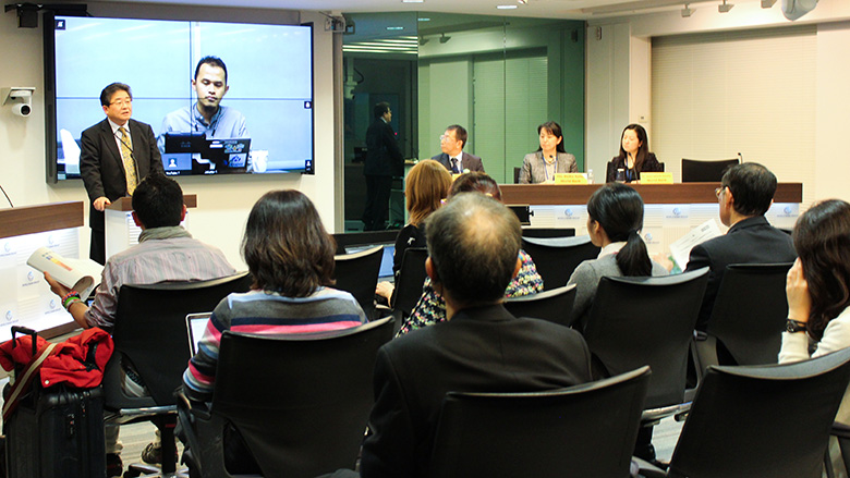
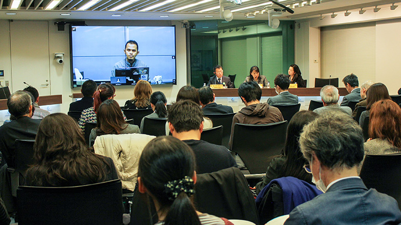
Mr. Yantisa Akhadi, Project Manager, InaSAFE, Humanitarian OpenStreetMap Team, Indonesia, reported on InaSAFE, a platform for identifying risks and using resulting risk information, which was developed by Indonesia’s National Disaster Management Agency/National Disaster Management Authority (BNPB) with the World Bank’s support.

InaSAFE collects data about geography and buildings, necessary for risk assessment, through the participation of local residents themselves. The platform has been used to determine the status of post-disaster damage and share the acquired information, and is beginning to be used also in the pre-disaster stage for simulations in designing DRM plans and dissemination of necessary information to residents. Mr. Akhadi noted that this approach was initiated in Jakarta and is beginning to be implemented in Surabaya, Indonesia’s second largest city, and now would be gradually introduced in provincial areas, where risk information is difficult to obtain.

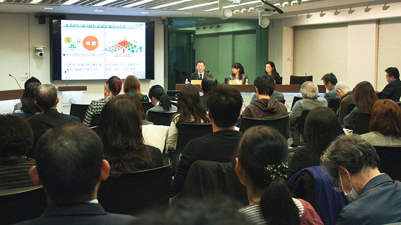
This seminar saw the participation of many people from the national government, the private sector, academic and research institutions, NGOs, and other bodies. During the discussion between the speakers and attendees, comments were made about the challenges of coordinating with developing countries’ DRM bodies—raised in part because such bodies are relatively new—and the importance of risk assessment with clearly defined objectives.


Image

Image

Image


Overview

Speakers
 

EVENT DETAILS
  • DATE/TIME: Friday, November 11, 2016, 04:30PM - 06:00PM (JST)
  • VENUE: The World Bank Tokyo Office, 10th Floor, Fukoku Seimei Building, 2-2-2 Uchisaiwaicho, Chiyoda-ku, Tokyo, Japan
  • LANGUAGE: English and Japanese (with simultaneous interpretation)
  • CONTACT: World Bank Disaster Risk Management Hub, Tokyo TEL: 03-3597-1320
  • drmhubtokyo@worldbank.org

Japan-World Bank Program for Mainstreaming Disaster Risk Management in Developing Countries


Welcome