
Overview
The Pacific Islands Countries (PICs), with a combined population of almost 10 million people, are highly exposed to natural disasters. In 2007, the World Bank established the Pacific Catastrophe Risk Assessment and Financing Initiative (PCRAFI) to develop disaster risk assessments tools and practical technical and financial applications to reduce and mitigate the countries' vulnerability to natural disasters. This initiative will contribute to improved post-disaster analysis and future disaster risk reduction planning for example, by reducing fiscal shocks through catastrophe financing, such as budget reserves, contingency facilities, or catastrophe insurance; or by establishing new building codes and rapid post-disaster assessments.
Challenge
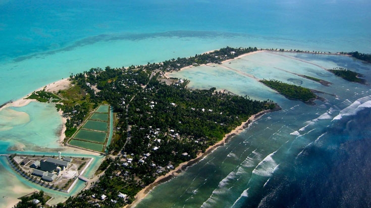
The Pacific is one of the most natural disaster prone regions on earth. PICs are vulnerable to natural hazards that include floods, droughts, tropical cyclones, earthquakes, volcanic eruptions, and tsunamis. Any one of these hazards can result in disasters that affect the countries’ entire economic, human, and physical environment and severely affect their long-term development agenda. Some of the countries are facing losses from a single event that would exceed their annual gross domestic product (GDP). The average annual direct losses caused by natural disasters in the South Pacific region are estimated at US$284 million.
Since 1950, natural disasters have affected approximately 9.2 million people in the Pacific region, causing 9,811 reported deaths. This has cost the PICs around US$3.2 billion (in nominal terms) in associated damage. In September 2009 a tsunami hit Samoa, American Samoa and Tonga. This tsunami left 150 people dead and some 5,300 people–2.5 percent of Samoa’s population–homeless. The tsunami also caused extensive damage to Samoa’s infrastructure. The cost of restoring infrastructure, maintaining access to basic social services, providing social safety nets to the affected population, and investing in disaster risk reduction, is expected to be around US$120 million, that is, 22 percent of GDP during the next three to four years.
The consequences of natural disasters are especially dire for the poor who tend to live in higher-risk areas, and typically have fewer options in terms of protection or risk mitigation. Population pressure, compounded by the effects of climate change, is likely to increase this vulnerability. Recognizing these trends, there is now widespread acceptance of the need to mainstream disaster risk and climate change in development planning and financing.
Approach
At the request of the PICs, the Secretariat of the Pacific Community (SPC)/Applied Geoscience and Technology Division (SOPAC), the World Bank, and the Asian Development Bank initiated work in 2007 aimed at quantifying the financial risk that countries face because of their exposure to natural disasters. These risk assessments, carried out using state-of-the-art risk modeling techniques, allowed the development of specific technical and financial solutions (or applications) to reduce or mitigate the effect of these risks.
The first step in developing catastrophe risk profiles for the PICs involved compiling a comprehensive historical catalogue of all recorded events in the region, including tropical cyclones, earthquakes and tsunamis. These historical records were then used to build an even more comprehensive database of simulated catastrophic events using additional technical information about the known behavior of tropical cyclones, earthquakes and tsunamis, such as expected wind speeds and the location of fault lines. This information is referred to as thehazard database.
The second step was to identify the geo-location, the characteristics and value of all assets that could be damaged by the catastrophic events. This information is referred to as the exposure database.
The third step was to estimate the damage caused to assets because of a catastrophic event.
The information from the first three steps was subsequently used to simulate many thousands of events and calculate risk profiles for each country. This information was also used to generate hazard and risk maps to identify the location of high-risk areas.
Once the risk profiles were calculated, they can be used in many different practical applications that can reduce or redistribute the risk over time. These applications are discussed in more detail below.
Results
The key result of this initiative is the Pacific Catastrophe Risk Information System (PacRIS)and the different practical applications that have been developed using the vast information the system contains. Another important result of the project is that PacRIS is managed and owned by SOPAC for the benefit of its member countries, thus achieving economies of scale and providing catastrophe risk data management services to it members. The following applications that have been developed so far will significantly help to reduce the risks these countries' 10 million people face every year.
- State-of-the-art catastrophe risk models. For each of the 15 PICs, state-of-the-art catastrophe risk models have been developed to assess the economic and fiscal impact of natural disasters, including earthquakes, tsunamis and tropical cyclones. In particular, the models estimate the economic losses caused by natural disasters with different return periods (for example, frequency of occurrence).
- Country disaster risk profiles. Risk profiles have been developed for all 15 PICs which integrate data collected and produced through the risk modeling process and include maps showing the geographic distribution of hazards, assets at risk, and potential losses that can be used to prioritize disaster risk management interventions. The profiles also include analysis of the distribution of the potential cost of natural disasters by magnitude over time for each country, as measured by the expected return period for losses of a specified amount. This analysis will be used to develop financing options to cover the cost of natural disaster risks.
- Disaster and Climate Risk Financing and Insurance. This application aims to assist the PICs in improving their macroeconomic planning against natural disasters, and the design and implementation of a national disaster risk financing strategy, as part of their national disaster risk management and climate change adaptation agenda.
Pacific Catastrophe Risk Information System (PacRIS)
The PacRIS is managed by the Secretariat of the Pacific Community (SPC)/Applied Geoscience and Technology Division (SOPAC). PacRIS itself consists of three large databases. Containing about a terabyte of data, PacRIS has information for 14 Pacific Island Countries and Timor-Leste. The system houses the most comprehensive historical catalogue of earthquakes and tropical cyclones, a database of geo-referenced fixed assets, and probabilistic analyses and mapping of risk carried out to date. PacRIS contains digitized maps describing residential buildings, major infrastructure such as roads, bridges and power stations, vegetation cover, crop maps, soil and topography, and bathymetry (sea depth). This information in PacRIS is being used for a number of practical applications.
- Database of Historical Tropical Cyclones and Earthquakes (Hazard Database). The database is the result of an exhaustive effort of collecting, merging, and processing data from multiple sources regarding historical Pacific earthquakes and tropical cyclones, and the monetary losses and impact on populations caused by these events. The historical earthquake catalogue currently includes about 115,000 events of magnitude 5 or greater that occurred in the region between 1768 and 2009, while the tropical cyclone catalogue includes 2,422 events from 1948 to 2008.
- Database of Accumulated Losses (Consequence Database). Most of these events did not have major consequences for the human population, infrastructure and residential buildings, or crops, but some did. A “consequence” database was assembled that contains approximately 450 events from 1831 to 2009 that affected at least one of the 15 PICs. This database, which is the most complete in existence for the Pacific region, shows that, on average, these countries have collectively experienced losses in the order of US$1 billion per decade, rising to US$4 billion in both the 1980s and the 1990s.
- Database of Assets Exposed to Disasters (Exposure Database). This database contains components for buildings and infrastructure, agriculture, and population. For the building and infrastructure dataset, more than 450,000 footprints (outlines) of structures were digitized (captured in computer) from high-resolution satellite images. These buildings represent about 30 percent of the estimated total number of buildings in PICs, and cover all urban buildings in the Pacific. Of these, about 80,000 were physically checked, photographed and classified. An additional 3 million, primarily rural buildings, were geolocated and classified using remote sensing techniques.
In addition to the infrastructure and residential buildings, the database also includes information on major cash crops, ground cover, topological maps and population. To date, this database is the most comprehensive exposure dataset for this part of the world. The estimated total replacement cost of all the assets in the 15 PICs is about US$113 billion, an amount that includes US$94 billion in buildings, US$15 billion in infrastructure assets, and US$4 billion in major crops.
Beneficiaries
The immediate beneficiaries of the PCRAFI are the members of the Pacific disaster risk management and climate change adaptation community, including the National Disaster Risk Management Offices, Ministries of Environment and other national agencies responsible for urban planning, agriculture, health, water, and energy; local nongovernmental organizations (NGOs) involved in community-based disaster risk management; regional technical centers such as the Secretariat of the Pacific Community SPC/SOPAC; multilateral development banks; bilateral donor agencies; and the private insurance and reinsurance industry. The ultimate beneficiaries are of course the people of the PICs who in the end, will benefit from more informed decisions on development planning and financing.
Bank Contribution
The Bank is providing knowledge accumulated from its work in disaster risk management initiatives in other regions, particularly Latin America and the Caribbean. The Bank is also providing technical leadership in the areas of risk modeling, finance, public expenditure analysis and geographic information systems development.
Partners
The PCRAFI is a joint initiative between the Secretariat of the Pacific Community (SPC)/Applied Geoscience and Technology Division (SOPAC), the World Bank, and the Asian Development Bank. To provide guidance on the various disaster risk management applications to be developed and implemented using the PCRAFI tools and to develop national ownership of the PCRAFI products, tools, and system, the establishment of a working group under the Pacific Disaster Risk Management (DRM) Partnership Network is under consideration.
This technical assistance initiative has had a total budget of US$3.3 million. Financial support of US$1.3 million has been made available by the Government of Japan under the World Bank-administered Japan Policy and Human Resources Development (PHRD) Technical Assistance (TA) program. Through the Asian Development Bank, the Japanese Government has provided an additional US$1 million to cover the costs of the field verification of data. The Global Facility for Disaster Reduction and Recovery (GFDRR) has contributed an additional US$1 million.
For the next phase of the project the ACP-EU Natural Disaster Risk Reduction Program funded by the European Commission provided funding of US$1,4 million to strengthen the Pacific risk information system and its use by Pacific island countries .
Toward the Future
PacRIS provides a powerful tool for managing catastrophe risk in the Pacific, through the development of applications to solve specific on-the-ground problems. Some of these applications are already under development and other potential uses are expected to emerge.
- Urban and development planning. Planners can use the information to evaluate changes to land use and zoning based on natural hazard risk, to develop investment plans to retrofit buildings for earthquakes, or to raise floor levels to avoid flooding due to tropical cyclones. The risk assessment can also be used to carry out cost benefit analyses of proposed disaster prevention or mitigation investments.
- Building codes. The earthquake and tropical cyclone hazard models provide critical information for building codes in terms of country-specific seismic and wind loads that buildings should be designed for to ensure adequate shelter for the population.
- Rapid disaster impact estimation. The aim of this application would be to use baseline information on assets already collected to model the expected losses from a catastrophic event immediately after a disaster. Rapid assessments will facilitate faster funds flows in post-disaster situations.